geographic locations & battlefield conditions
The geographic location of this battle took place on the small island of Okinawa, just south of the main island of Japan. It is known as the bloodiest battle of the Pacific war. On the invasion day April 1, 1945 American and Allied troops were met with little opposition when coming into Hagushi Bay. The real conflict took place in the south of the island after all other opposition, besides guerrilla fighters, were eradicated in the North. The Japanese leadership, for the most part, knew the war was lost. Strategically, they were fighting a battle to prevent an invasion of the mainland of Japan. The method they used was to extract as much blood from the U.S. soldiers that approached.
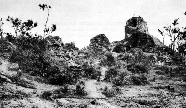
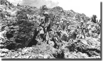
The conditions of the battle grounds turned into a mess after days of continuous rain, mud was everywhere, making it hard to move. The terrain from the northern part of the island was a very mountainous and wooded area with twisted masses of rocky ridges, making it difficult for Allied forces to navigate the place. Japan lost around 7,166 soldiers who either committed suicide or were killed and the allies had near 14,009 deaths.
The conditions of the battle grounds turned into a mess after days of continuous rain, mud was everywhere, making it hard to move. The terrain from the northern part of the island was a very mountainous and wooded area with twisted masses of rocky ridges, making it difficult for Allied forces to navigate the place. Japan lost around 7,166 soldiers who either committed suicide or were killed and the allies had near 14,009 deaths.
|
|
